|
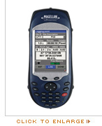
FAST Survey™ is a field software provided to comply with demanding requirements, such as compatibility with a wide range of survey instruments, extensive data formats and local coordinate system availability. FAST Survey includes topographic features typically associated with dual-frequency. These easy-to-use features make it possible for professional surveyors and novice GPS users alike to run complete survey jobs, including stake out, and combining projects done in association with total stations. More …
|
|
|
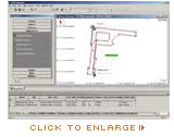
GNSS Solutions™ office software is a comprehensive survey software package with all the tools required to successfully process GPS, GLONASS and SBAS survey data. Focusing on simplicity, the software performs quick and easy data transfer and management. More …
|
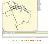
MobilMapper™ Office software links the ProMark 3 and ProMark3 RTK receivers to the GIS database. Simply upload shape files and other GIS data to be updated in the field. Editing data and exporting .SHP, .MIF, .DXF and .CSV files is easy. Upload basemaps and vector background maps to the free memory or to an SD card. More … |
|
|
|
|
|