|
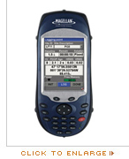
ProMark 500 Compatible | ProMark3 RTK Compatible
FAST Survey™ software is a graphical field solution designed to optimize the functionality and performance of the Magellan GPS systems for topography and construction. FAST Survey provides innovative, flexible support for a wide range of instruments and data formats.
Graphical Displays
FAST Survey is a graphical, easy-to-use field solution. A scaleable map view displays points and lines as they are surveyed, offering large-print controls for rapid, reliable data collection. Menu access through an intuitive tab-based interface means that mission critical menus are visible from all screens and no time is spent scrolling through menus in the field.
|
 |
Advanced Features and Options
Integrated control of GPS systems, conventional total stations and robotic total stations (option) is a snap, with seamless transitions within the same job file. The flexible, modular structure of FAST Survey enables you to meet the changing needs of today’s job and tomorrow’s opportunity. Rich attributing, full editing in the field and export to industry standard data formats provides true field-to-finish capability, saving time and effort. Advanced features like offset staking, slope staking, cut-sheet export and road templates (option) deliver productivity for road construction projects, putting even large projects within reach. Support for industry standard file formats like DXF, SHP, LandXML and RW5 opens channels of compatibility with client software. Take control and work with the best tool for the job – FAST Survey.
|
|