|
ProMark3 RTK Compatible | ProMark 3 Compatible
GIS Sub-Meter Accuracy within Reach
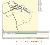
MobileMapper™ Office is a powerful office software that provides an easy way to view, edit and export GIS data collected on the ProMark 3 receiver range. MobileMapper Office enables you to update maps, post process GPS data and store GIS information for analysis. It’s the ideal software for anyone managing assets in the field.
Connecting Field Assets with Geographic Information Systems
MobileMapper Office is easy to use as it links your GPS receiver to your GIS. Simply upload shape files and other GIS data to be updated in the field. You can quickly convert standard GIS files, editing and exporting .SHP, .MIF, .DXF and .CSV files is easy. |
 |
Easy to Deploy
The user-friendly features of MobileMapper Office make it easier to deploy and easier to use than any other mobile mapping solution. It is the ideal tool for anyone who maintains GIS data and maps, with an intuitive, easy-to-learn interface.
When you need to correct maps, create feature libraries and update a GIS system for a client or in-house, MobileMapper Office provides the tools you need to keep up with changing data. |
|