|
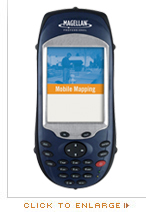
Mobile Mapping Application
Together with Magellan's Mobile Mapping application, MobileMapper CX offers a turn key solution for all your GIS needs. The software is intuitive, making proficient use quick and easy with minimum training, and includes the GPS features you really need without the burden of overly complicated, rarely used functions.
This optional Magellan software provides you with easy-to-use features such as:
- GIS feature libraries for logging feature descriptions
- Point, line and area mapping from an easy to learn and use menu structure
- Area calculation in the field for real-time area determination. Area data can be post-processed in the office to enhance accuracy
- Supports Raster and Vector map formats
- Offset function for logging hard to reach features. This function eliminates the need to physically occupy a feature, you simply need to input the distance and bearing to the feature
- Nesting function for logging features without closing other features already being logged, e.g. inserting a telephone pole while mapping a road
- Repeat feature function for rapid logging of features with identical descriptions, e.g. poles along a road
- Grid mapping utility for collecting evenly distributed measurements (water depth, chemical concentration, etc.) required for contour map generation
- Software feature for collecting raw data for post-processed differential correction
|
 |
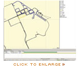
MobileMapper Office
Driven by the powerful office support software, MobileMapper Office, MobileMapper CX provides clear and simple data display, editing and export capabilities. MobileMapper CX makes creating or updating maps for analysis and storage in any Geographic Information System quick and easy.
MobileMapper Office links the receiver to the GIS base system and provides convenient features such as:
- Full feature library generation
- Preparation of job files for field data collection
- Creating and editing lists of features and attributes for describing GIS assets in the field
- Quick and easy display, editing and exporting of data. Includes support for .SHP, .MIF, .DXF and .CSV files
- Uploading or creating of vector background maps for use in the field
- Post-processing of code and phase data recorded with the field receiver
|
 |
|
|
|
|