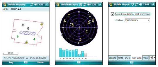
Mobile Mapping Application
Magellan’s Mobile Mapping software provides easy-to-use and simple yet professional and effective GIS data collection capabilities. Use this application to create and update maps for analysis and maintenance in a standard GIS system.
This is an ideal solution for such GIS professionals as foresters, farmers, safety personnel, utility workers, and anyone who manages positioned assets in the field.
The Mobile Mapping application includes all GPS features that GIS professionals really need without the burden of complicated and rarely used functions. The software is very intuitive and easy-to-use, requiring a minimum of training, making it easy to work with complicated and unfamiliar GIS data sets.
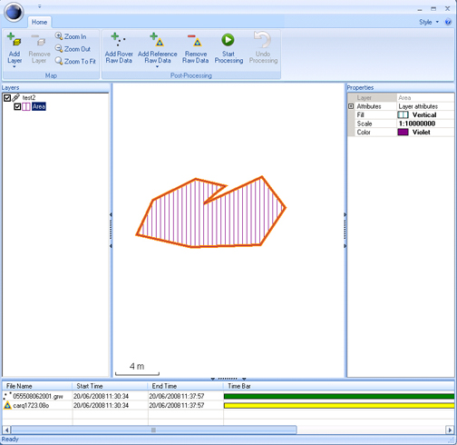
MobileMapper 6 Office
The new MobileMapper 6 Office tool can be used to differentially post-process raw GPS data collected with the Magellan Mobile Mapping software. Through post-processing, the positions of every GIS feature you collect in the field can be improved to 1-2 meters accuracy.
Thanks to BLADE™ Magellan unique processing algorithm, post-processing raw data with MobileMapper 6 Office is extremely efficient and straightforward. Through an Internet connection, MobileMapper 6 Office can automatically find and download the base data files that will match the collected raw data. MobileMapper 6 Office also allows project preparation, synchronization with Mobile Mapping software and the management of your GIS maps and data.
|